

Capture | Process | Deliver
Aerial Services

Sky High Expectations
What's Aerial Remote Sensing?
Aerial UAS (Unmanned Aerial Systems) remote sensing services encompass a suite of advanced technologies deployed via drones to collect critical data from the environment. LiDAR services utilize laser scanning to produce highly accurate 3D models of the terrain, structures, and vegetation. Photogrammetry involves capturing a series of overlapping photographs from which software can generate detailed maps and models, offering insights into topographical features and aiding in volumetric calculations. Gas detection sensors mounted on UAS can identify and measure the concentration of various gases, which is crucial for monitoring environmental pollution or detecting leaks in industrial settings. Thermal imaging, using thermal cameras, can capture temperature variations on the ground, invaluable for assessing energy loss in buildings, detecting water stress in crops, or observing wildlife. These versatile UAS services provide comprehensive data that supports decision-making in fields such as agriculture, construction, environmental management, and public safety, enabling detailed analysis and monitoring with greater flexibility and reduced risk compared to traditional methods.


We Take Pride in Our Numbers
700,000
Lasers a second
1 Million+
Acres scanned processed & delivered
100s
of Satisfied Customers
First
First Aerial Services Provider on the Northshore
7years
As an Industry Leader
Benefits
Exceptional Quality
Enhanced Safety
UAS operations can significantly reduce the risk to human life by accessing hazardous or difficult-to-reach areas without putting personnel in harm's way.
Cost Efficiency
By deploying UAS for aerial surveys and inspections, companies can save on the costs associated with traditional manned aircraft operations, including fuel, maintenance, and pilot fees.
Time Savings
UAS can be quickly deployed and cover large areas in a fraction of the time required by traditional ground-based methods or manned aircraft.
High-Quality Data
With advanced sensors, UAS can capture high-resolution images and data, providing detailed insights for decision-making.
Easily Accessible
UAS can reach areas that are otherwise inaccessible or challenging for humans or ground vehicles, such as mountainous terrain, dense forests, or disaster zones.
Frequent Monitoring
The ease of deploying UAS makes it possible to conduct regular and repeated surveys, which is essential for monitoring changes over time, such as construction progress or environmental shifts.

Advanced Analysis
The data collected by UAS can be used with sophisticated algorithms for detailed analysis, such as 3D modeling, volumetric calculations, and change detection.
Compliance and Documentation
UAS can help businesses comply with regulatory requirements by providing accurate documentation and records of their operations and assets.
Integrated Data Solutions
UAS data can easily be integrated with GIS and other data systems, enhancing existing databases with aerial perspectives.
Reduced Environmental Impact
UAS operations are typically less intrusive and have a smaller carbon footprint compared to traditional methods involving heavy machinery or manned aircraft.

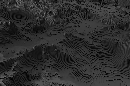
Aerial LiDAR
Dive into the forefront of aerial mapping with our unmatched UAS Aerial LiDAR service! Ideal for professionals across various sectors—from forestry and infrastructure to archaeology and environmental research—our service offers rapid, high-resolution topographical data collection. By employing state-of-the-art drones equipped with cutting-edge LiDAR technology, we can penetrate dense vegetation and capture the bare earth beneath, revealing terrain details that traditional methods might miss. Our 3D point cloud data, characterized by its unparalleled accuracy and density, empowers you to visualize, analyze, and execute projects with heightened precision. Committed to excellence and backed by a team of experts, we ensure your objectives are met with speed and precision. Illuminate the unseen and transform your spatial understanding with our world-class UAS Aerial LiDAR service.
TDLAS Gas Detection
Discover the unmatched capabilities of Tunable Diode Laser Spectrometry for gas detection in the most demanding environments. Our cutting-edge TDLAS technology doesn't just detect gas—it identifies and quantifies up to 20 different gases with impeccable precision. What truly sets TDLAS apart is its extraordinary sensitivity, detecting concentrations as low as 1 part per million. Whether you're safeguarding pipelines or ensuring the integrity of oil and gas facilities, trust in TDLAS to provide comprehensive coverage and unparalleled accuracy. With TDLAS, you're not merely detecting—you're achieving a new benchmark in precision and safety, ensuring every gas, every time, is accounted for.


Optical Gas Imaging
Unlock the future of advanced gas detection with UAS Aerial Optical Gas Imaging! By harnessing the power of cutting-edge aerial technology, our solution provides an unparalleled advantage in detecting gas leaks on pipelines and within oil and gas facilities. No longer will companies have to rely solely on ground-based inspections. With our aerial imaging, you can identify potential leaks from a bird's-eye view, ensuring that even the most minute emissions are detected swiftly and efficiently. This not only guarantees the safety of your operations but also demonstrates your commitment to environmental responsibility. Embrace innovation, enhance safety, and ensure compliance with the most modern and efficient gas detection method available.
Photogrammetry
Step into the next dimension of spatial data with our cutting-edge UAV photogrammetry service! Whether you're mapping urban landscapes, tracking environmental changes, or planning large-scale developments, our service delivers high-definition 3D models with unparalleled precision. Utilizing the latest in drone technology, we transform aerial photographs into intricate digital terrains, offering you insights that are both vast in scope and detailed in depth. Our photogrammetric models serve as invaluable tools for analysis, visualization, and project execution. With a commitment to accuracy, efficiency, and client satisfaction, we bring the world to your fingertips in stunning detail. Discover the power of perspective and elevate your projects with our top-tier UAV photogrammetry service.


Volumetrics
Unlock a new dimension in volume analysis with our specialized UAS Photogrammetry Volumetric service! Designed for industries that require precise volume measurements—from mining and agriculture to construction and waste management—our service delivers pinpoint accuracy in volumetric assessments. By utilizing the latest drone technology coupled with advanced photogrammetry techniques, we transform aerial captures into detailed 3D models, enabling you to measure stockpiles, excavation pits, and various terrains with unparalleled precision. Gone are the days of tedious manual measurements and guesswork. Our volumetric solutions provide rapid, reliable, and repeatable results, streamlining your operations and enhancing productivity. Partner with us and redefine accuracy in volumetric analysis with our state-of-the-art UAS Photogrammetry Volumetric service.
Orthomosaic
Unlock the future of aerial imaging with our state-of-the-art UAV orthomosaic service! Whether you're in agriculture, urban planning, or environmental research, our high-resolution, precision-stitched aerial images provide unparalleled clarity and detail. By harnessing the power of advanced UAV technology, we capture comprehensive views of vast areas, ensuring every inch is depicted with unmatched accuracy. Our orthomosaics not only give you a bird's-eye view but also offer actionable insights, aiding in better decision-making. With fast turnaround times, competitive pricing, and dedicated customer support, our service is tailored to meet your unique needs. Elevate your operations to new heights and see the bigger picture, clearer than ever before, with our UAV orthomosaic service.


Thermal Imaging
Experience the power of vision beyond the visible spectrum with our advanced UAS Thermal Imaging service! Perfect for a wide range of industries, from agriculture and construction to security and wildlife conservation, our service offers unparalleled insights by detecting temperature variations from the sky. Using top-tier drones equipped with sophisticated thermal sensors, we unveil hidden patterns, energy losses, moisture content, and even unseen objects or individuals in low-visibility conditions. Our high-resolution thermal data not only provides a unique perspective but also delivers actionable insights for enhanced decision-making. Complementing our state-of-the-art technology is a team of dedicated professionals, ensuring you receive precise, timely, and actionable results. Illuminate the invisible and make informed decisions with our industry-leading UAS Thermal Imaging service.
Hyperspectral / Multispectral
Embark on a journey of unrivaled clarity with our Aerial UAS Multispectral and Hyperspectral services. These advanced imaging techniques are revolutionizing industries by providing insights that go far beyond traditional aerial photography. For agriculture, benefit from precise crop health assessments, optimized irrigation strategies, and early pest detection, ensuring maximum yield and productivity. In the realm of environmental monitoring, track changes in ecosystems, assess water quality, and monitor forest health with pinpoint accuracy. Geologists and mineral explorers can use these services to identify mineral compositions, aiding in efficient exploration. Urban planners benefit from enhanced land use classification, heat mapping, and infrastructure assessments. Every sector, from forestry to coastal studies, can leverage the depth of information our aerial imaging provides. With UAS Multispectral and Hyperspectral services, you're not just viewing the world; you're understanding it, layer by intricate layer.


RGB - Photo & Video
Transform your industrial operations and marketing strategies with our premier UAS Photo and Video service, tailored specifically for industrial applications, inspections, marketing, and the construction sector. Harnessing the capabilities of advanced drone technology, we provide crystal-clear aerial imagery and ultra-smooth videos that redefine precision and detail. Whether you're inspecting intricate infrastructure components, showcasing a construction project's progress, or crafting a compelling marketing campaign, our aerial visuals offer a unique, bird's-eye perspective that elevates your content to a professional standard. Our team of experts ensures each capture meets industry-specific requirements, delivering content that's not only visually stunning but also invaluable for analysis, documentation, and promotional efforts. Elevate your industry operations and storytelling with unmatched aerial clarity and precision through our UAS Photo and Video service.
Services
ecko360 industrial is the go-to provider for advanced UAV remote sensing services in the Gulf Coast region. Our team of experts has the experience and expertise to deliver accurate, reliable data that can help you take your project to the next level. Contact us today to learn more about our services.


